
01. Bienvenida
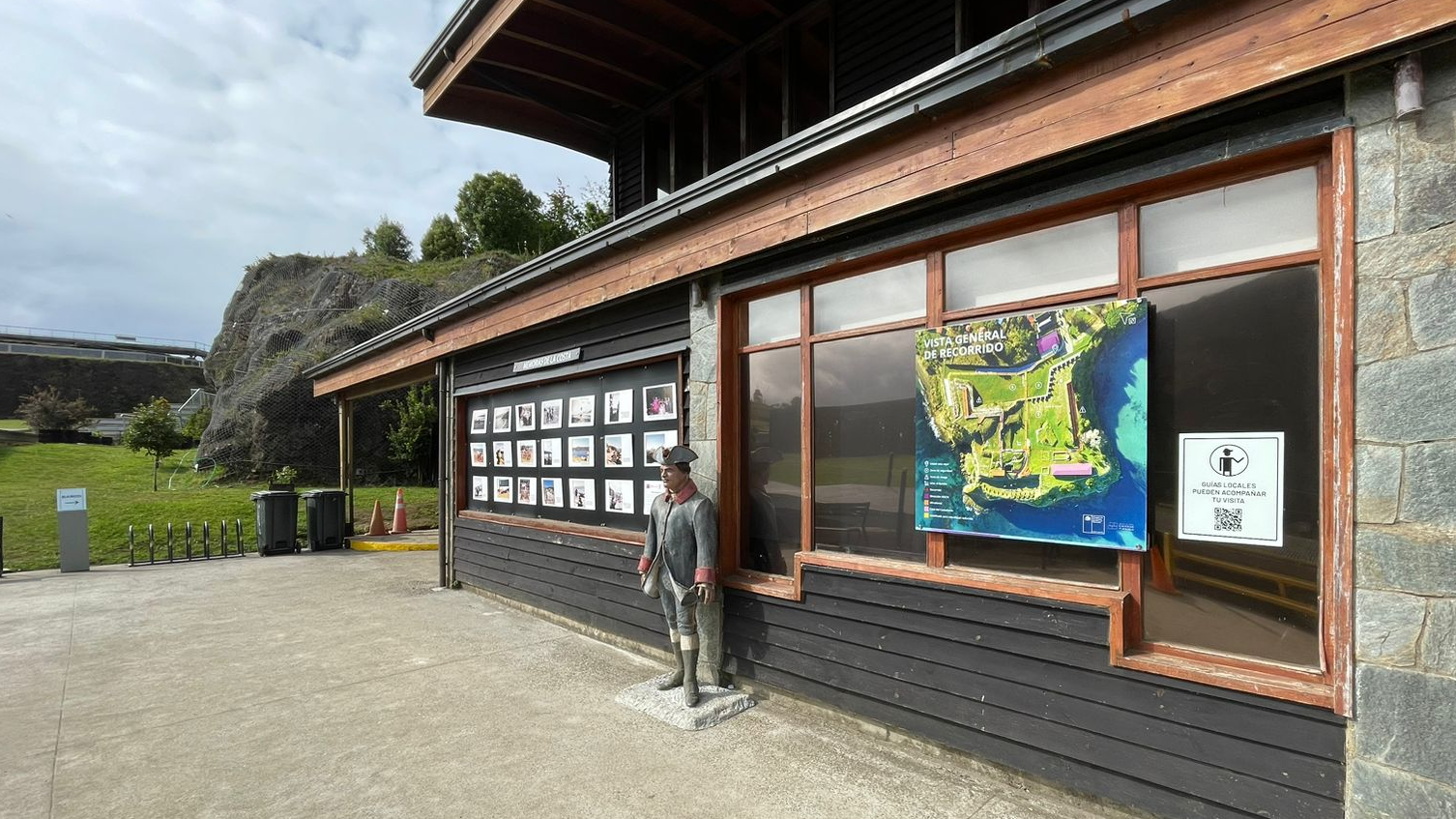
Damos la bienvenida al Museo de Sitio Castillo de Niebla, un espacio de encuentro dedicado a poner en valor el sistema de fortificaciones del estuario del río Valdivia.
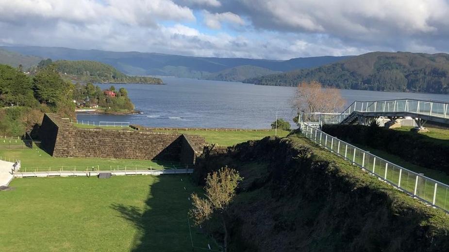
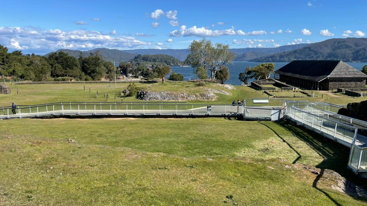
Nos encontramos frente a las oficinas administrativas y depósito de colecciones del museo. El recorrido se inicia por la pasarela que se dirige hacia el fondo, en dirección al mar.
Welcome to the Museo de Sitio Castillo de Niebla, a meeting place dedicated to highlighting the value of the fortification system of the Valdivia River estuary.
We are in front of the administrative offices and the museum's collection storage area. The tour begins on the walkway that leads to the bottom, towards the sea.
02. Museo de sitio
El Castillo de la Pura y Limpia Concepción de Monforte de Lemos, como fue bautizado originalmente, forma parte del sistema defensivo ideado por la monarquía católica para la protección del virreinato del Perú y el control de las rutas comerciales del Pacífico Sur.
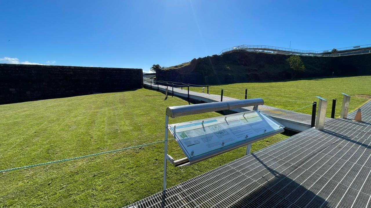
El museo de sitio se despliega por más de dos hectáreas con pasarelas con paneles informativos. Tanto las estructuras visibles como las subyacentes, hablan de su permanente evolución y ocupación continua, desde un puesto militar hacia un hito turístico de interés mundial.
Quienes realizaron el trabajo de caminos, carpintería de ribera o cantería fueron presidiarios y relegados traídos desde diversas partes del virreinato del Perú.
The Castillo de la Pura y Limpia Concepción de Monforte de Lemos, as it was originally named, is part of the defensive system devised by the Catholic monarchy to protect the viceroyalty of Peru and control the trade routes of the South Pacific.
The site museum is spread over more than two hectares with walkways and information panels. Both the visible and underlying structures speak of its permanent evolution and continuous occupation, from a military post to a tourist landmark of worldwide interest.
Those who worked on the roads, carpentry or stonemasonry were convicts and recluses brought from different parts of the viceroyalty of Peru.
03. La Cancagua
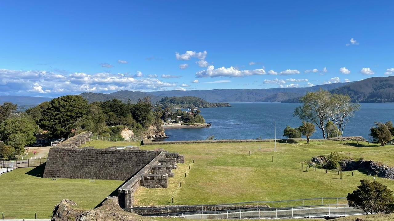
El Castillo de Niebla está ubicado en la orilla norte de la desembocadura del río Valdivia y es parte de un sistema defensivo con enclaves desde Mariquina hasta Chiloé. Para su construcción se recurrió a los recursos disponibles en el lugar. El baluarte norte fue directamente tallado en el promontorio de roca. Los bloques con los que se levantaron el baluarte sur y los edificios interiores se labraron con el material extraído del foso, fundamentalmente piedra sedimentaria arenisca conocida localmente como Cancagua.
The Castillo de Niebla is located on the northern shore of the mouth of the Valdivia River and is part of a defensive system with enclaves from Mariquina to Chiloé. For its construction, the resources available in the area were used. The northern bastion was carved directly into the rock promontory. The blocks used to build the southern bastion and the interior buildings were carved from the material extracted from the moat, mainly sandstone sedimentary stone known locally as Cancagua.
The Castillo de Niebla is located on the northern shore of the mouth of the Valdivia River and is part of a defensive system with enclaves from Mariquina to Chiloé. For its construction, the resources available in the area were used. The northern bastion was carved directly into the rock promontory. The blocks used to build the southern bastion and the interior buildings were carved from the material extracted from the moat, mainly sandstone sedimentary stone known locally as Cancagua.
04. El Río Valdivia
La cuenca hidrográfica del río Valdivia se origina en el lago Lácar, en Argentina. Desde ahí baja en cadena consecutiva de ríos y lagos, generando una red hídrica con más de diez mil doscientos kilómetros cuadrados.
Cientos de años antes de que los europeos llegaran en sus barcos de madera, había un gran pueblo viviendo aquí, los mapuche.
La población indígena de este territorio fue descrita en 1544 por la expedición de Juan Bautista Pastene, en la búsqueda de resguardos para el viaje interoceánico. El 9 de febrero de 1552 Pedro de Valdivia fundó la ciudad de Santa María La Blanca del Dulce Nombre. En 1599, el pueblo mapuche recuperó el territorio destruyendo las siete ciudades más grandes del sur del río Biobío.
The hydrographic basin of the Valdivia River originates in Lake Lácar, in Argentina. From there it descends in a consecutive chain of rivers and lakes, generating a water network of more than ten thousand two hundred square kilometers.
Hundreds of years before the Europeans arrived in their wooden ships, there was a great people living here, the Mapuche.
The indigenous population of this territory was described in 1544 by the expedition of Juan Bautista Pastene, in the search for safeguards for the inter-oceanic voyage. On February 9, 1552 Pedro de Valdivia founded the city of Santa María La Blanca del Dulce Nombre. In 1599, the Mapuche people recovered the territory by destroying the seven largest cities south of the Biobío River. .
05. Refundación
En Valdivia, la Compañía Neerlandesa de las Indias Occidentales estableció una colonia en 1643, partiendo a los pocos meses. Como respuesta, el Virrey del Perú ordenó una expedición repobladora a cargo de su hijo Antonio de Toledo. La guarnición quedó conformada por setecientos soldados, armados con veintiséis piezas de artillería de bronce con sus cureñas, municiones, pertrechos y bastimentos para más de dos años. La ciudad fue refundada en la isla de Mancera el 4 de febrero de 1645 y, finalmente, en 1647, Valdivia volvió a su emplazamiento original río arriba, donde se ubica actualmente.
In Valdivia, the Dutch West India Company established a colony in 1643, leaving a few months later. In response, the Viceroy of Peru ordered a repopulating expedition under his son Antonio de Toledo. The garrison consisted of seven hundred soldiers, armed with twenty-six pieces of bronze artillery with their carriages, ammunition, supplies and provisions for more than two years. The city was re-founded on the island of Mancera on February 4, 1645 and finally, in 1647, Valdivia returned to its original location upriver, where it is located today.
In Valdivia, the Dutch West India Company established a colony in 1643, leaving a few months later. In response, the Viceroy of Peru ordered a repopulating expedition under his son Antonio de Toledo. The garrison consisted of seven hundred soldiers, armed with twenty-six pieces of bronze artillery with their carriages, ammunition, supplies and provisions for more than two years. The city was re-founded on the island of Mancera on February 4, 1645 and finally, in 1647, Valdivia returned to its original location upriver, where it is located today.
06. Un sistema
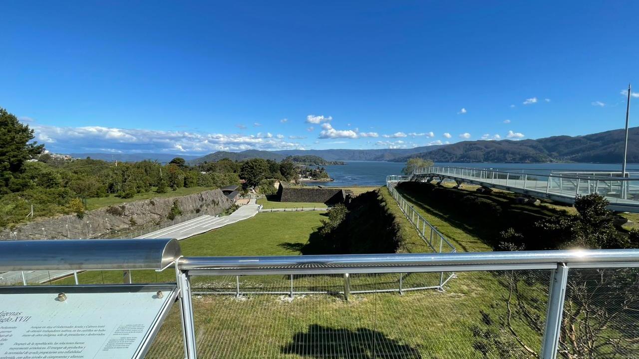
Desde este sector, es posible apreciar la posición estratégica del Castillo y su ubicación respecto a los demás puntos fortificados de la desembocadura del río. En la ribera sur se pueden observar las murallas del Castillo de San Luis de Alba de Amargos y el Castillo de San Sebastián de la Cruz en Corral. Hacia el este se reconoce el Castillo de San Pedro de Alcántara en la isla de Mancera.
El sistema fortificado funcionaba como un todo engranado, compuesto por una veintena de puntos defensivos, entre fuertes, fortines, baterías, vigías y castillos.
From this sector, it is possible to appreciate the strategic position of the castle and its location with respect to the other fortified points at the mouth of the river. On the south bank, the walls of the Castillo de San Luis de Alba de Amargos and the Castillo de San Sebastián de la Cruz in Corral can be seen. To the east is the Castle of San Pedro de Alcántara on the island of Mancera.
The fortified system functioned as an interlocking whole, composed of about twenty defensive points, including forts, forts, batteries, watchtowers and castles.
07. El entorno
Alrededor de la fortificación se construyeron edificios y viviendas extramuros para población civil y militar. En 1749, José Perfecto de Salas indicó que la guarnición de Niebla estuvo conformada por más de cuarenta hombres y reconoció un vecindario extramuros de veintisiete casas.
Rodeando el estero La Huairona, eje del poblado, había caminos y muelles que la unían con la Avanzada y Batería del Molino, de la Cruz, la fábrica de ladrillos de La Huairona, las Fábricas Reales de la isla Teja y la ruta del correo por la costa. Hacia el interior, en 1776, se levantó la Misión de Niebla o Misión Franciscana de Cristo Crucificado.
Around the fortification, buildings and dwellings were constructed outside the walls for the civilian and military population. In 1749, José Perfecto de Salas indicated that the garrison of Niebla consisted of more than forty men and recognized a neighborhood outside the walls of twenty-seven houses.
Surrounding the estuary La Huairona, axis of the town, there were roads and docks that linked it with the Avanzada and Batería del Molino, de la Cruz, the brick factory of La Huairona, the Royal Factories of Teja Island and the mail route along the coast. Towards the interior, in 1776, the Mission of Niebla or Franciscan Mission of Christ Crucified was built.
08. La batería
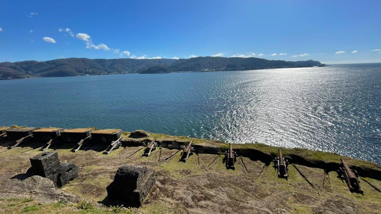
El lugar donde se ubican los cañones de un castillo es conocido como batería. En Niebla, fue labrada en la roca viva y cruzaba fuegos con el Castillo de Amargos. Tuvo un número variable de cañones de alto calibre. Los cañones eran montados en carros, conocidos como cureñas. A mediados del siglo dieciocho, el ingeniero irlandés Juan Garland ordenó el rebaje de la batería, el tallado de rampas, escaleras y el acceso al muelle. Se complementó posteriormente con hornos de piedra cancagua para calentar balas.
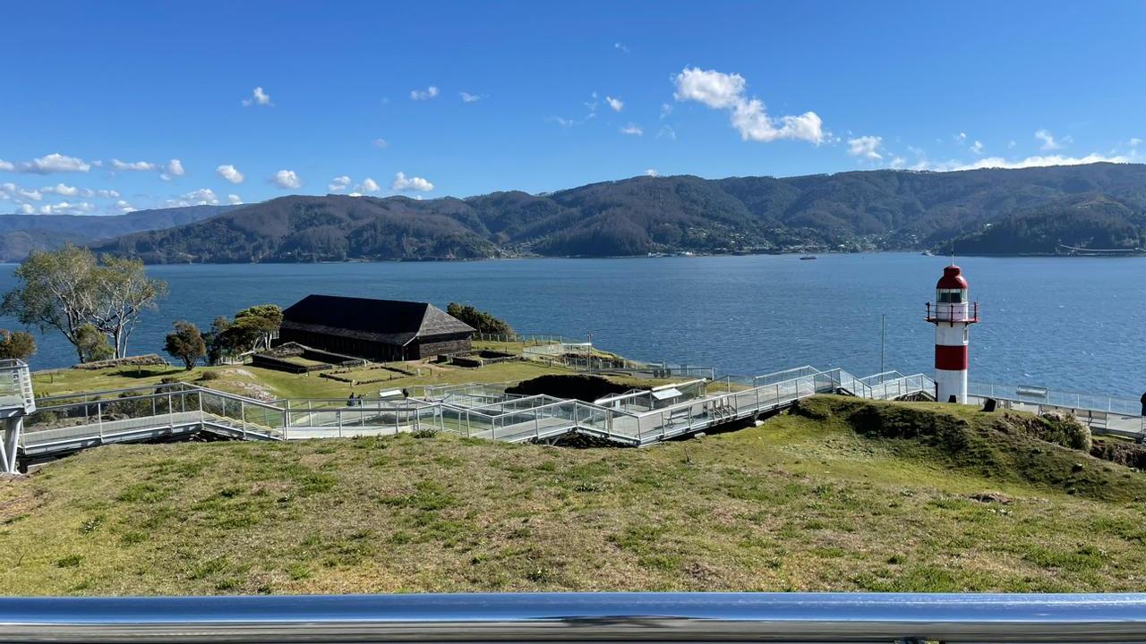
Al costado este de la pasarela de recorrido se encuentra el polvorín, en una cavidad creada en la roca y bajo el relieve para no ser visto desde el mar.
Posterior a la toma de Valdivia en 1820, Niebla persistió como faro, además de realizarse intermitentes campañas de ejercicios militares.
The place where the cannons of a castle are located is known as a battery. In Niebla, it was carved in the living rock and crossed fires with the Amargos Castle. It had a variable number of high caliber cannons. The cannons were mounted on carriages, known as “cureñas”. In the mid-eighteenth century, the Irish engineer Juan Garland ordered the lowering of the battery, the carving of ramps, stairs and access to the pier. It was later complemented with cancagua stone furnaces to heat bullets.
On the east side of the walkway is the powder magazine, in a cavity created in the rock and under the relief so as not to be seen from the sea.
After the capture of Valdivia in 1820, Niebla persisted as a lighthouse, in addition to intermittent military exercise campaigns.
09. Cañones
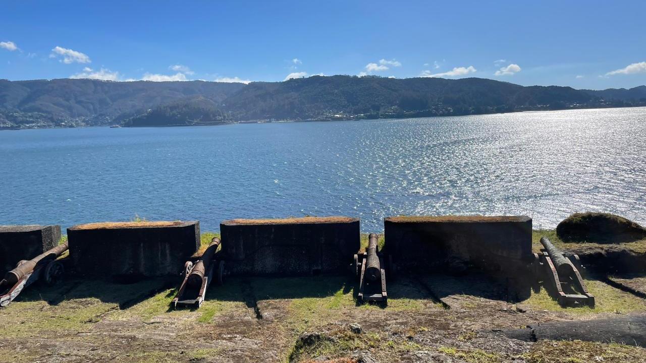
Actualmente se exhiben catorce cañones de fierro fundido. En la época, el calibre de cada una de estas armas se medía por el peso de las balas que podía disparar y, en este caso, la mayoría eran de veinticuatro libras, equivalentes a casi once kilos. La mitad de los cañones son del periodo de ocupación y el resto, reproducciones hechas como elementos de apoyo museográfico. El acceso se encuentra deshabilitado para seguridad de los y las visitantes, debido a la inestabilidad del terreno donde se asienta.
Fourteen cast iron cannons are currently on display. At the time, the caliber of each of these weapons was measured by the weight of the bullets it could fire and, in this case, most were twenty-four pounds, equivalent to almost eleven kilos. Half of the cannons are from the occupation period and the rest are reproductions made as museum props. Access is disabled for the safety of visitors, due to the instability of the terrain where it is located.
Fourteen cast iron cannons are currently on display. At the time, the caliber of each of these weapons was measured by the weight of the bullets it could fire and, in this case, most were twenty-four pounds, equivalent to almost eleven kilos. Half of the cannons are from the occupation period and the rest are reproductions made as museum props. Access is disabled for the safety of visitors, due to the instability of the terrain where it is located.
10. Intramuros
Al interior del Castillo la vida se realizaba generalmente al ritmo de las misas diarias y las escasas raciones de legumbres, cebada y charqui.
A la Casa del Castellano se adicionaba una capilla, cuyos restos se ven al costado; también la casa del capellán y el almacén. Además existían otras estructuras, como la cocina, la panadería, la herrería y las cuevas.
Inside the castle life was generally carried out to the rhythm of the daily masses and the scarce rations of vegetables, barley and charqui.
To the Casa del Castellano was added a chapel, whose remains can be seen on the side; also the chaplain's house and the storehouse. There were also other structures, such as the kitchen, the bakery, the blacksmith's shop and the caves.
11. Casa del Castellano
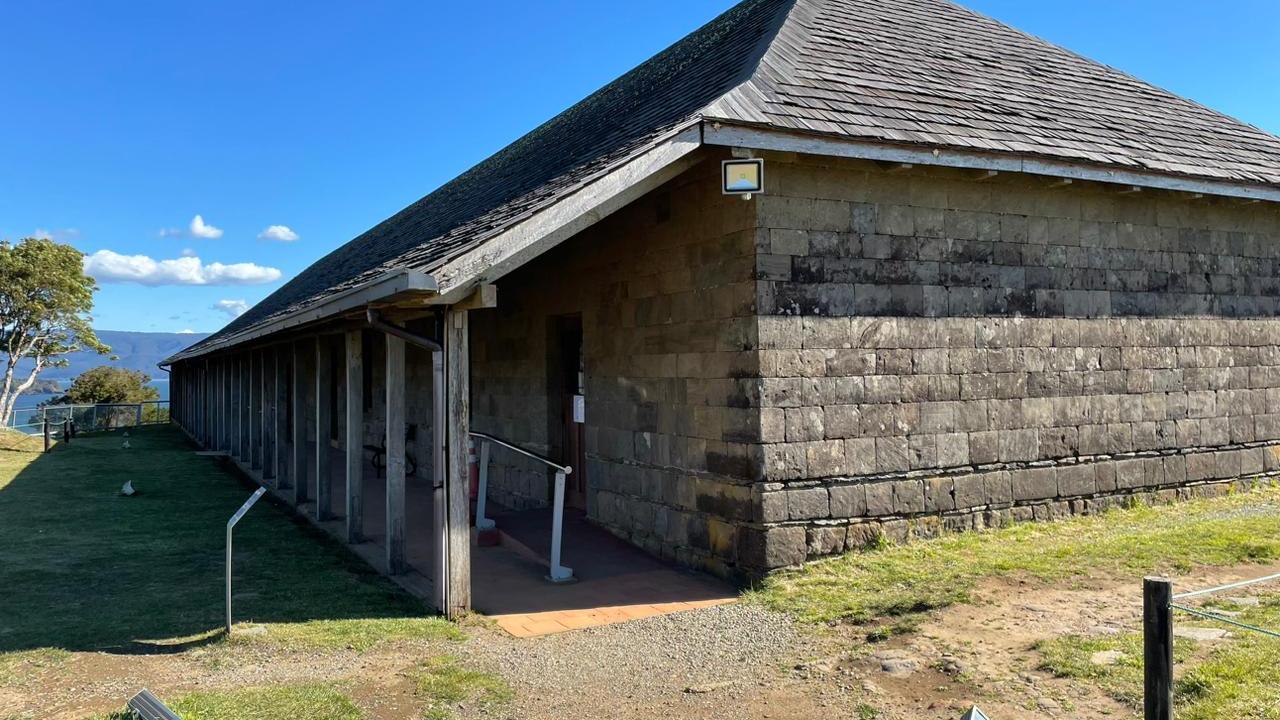
Reconstruida en 1992, la Casa del Castellano cuenta con cuatro salas de exhibición permanente, que integran paneles informativos, vitrinas, maniquís y una sala de exhibición temporal. Su relato museográfico comienza con cartografías y una pareja mapuche con vestimentas tradicionales.
La segunda sala de la Casa del Castellano ilustra la interacción de los puntos defensivos del sistema fortificado del estuario del río Valdivia. Está dominada por una maqueta que representa la bahía, ilustrada por el cartógrafo José de Moraleda en 1788.
Sala 3. En esta sala se exhiben características constructivas de los castillos y se pueden conocer las unidades de medidas, las herramientas y los materiales. Desde los primeros emplazamientos con fajinas (o ramas), hasta la edificación de los baluartes en piedra cancagua y otras técnicas de construcción.
Sala 4. Cuando las principales posesiones hispánicas comenzaron a ceder ante los ejércitos republicanos, una expedición comandada por el británico Thomas Cochrane realizó el ataque al sistema defensivo por tierra, desde una retaguardia sin defensa, rompiendo el cerco que mantenía en poder de la monarquía católica este estratégico “antemural del Pacífico”.
Rebuilt in 1992, the Casa del Castellano has four permanent exhibition rooms, which include information panels, display cases, mannequins and a temporary exhibition room. Its museographic story begins with cartographies and a Mapuche couple in traditional dress.
The second room of the Casa del Castellano illustrates the interaction of the defensive points of the fortified system of the Valdivia River estuary. It is dominated by a model representing the bay, illustrated by the cartographer José de Moraleda in 1788.
Room 3. This room exhibits construction characteristics of the castles and shows the units of measurement, tools and materials. From the first emplacements with fajinas (or branches), to the construction of the bastions in cancagua stone and other construction techniques.
Room 4. When the main Hispanic possessions began to yield to the Republican armies, an expedition commanded by the British Thomas Cochrane attacked the defensive system by land, from an undefended rearguard, breaking the siege that kept this strategic “Pacific antemural” in the hands of the Catholic monarchy.
12. Murallas
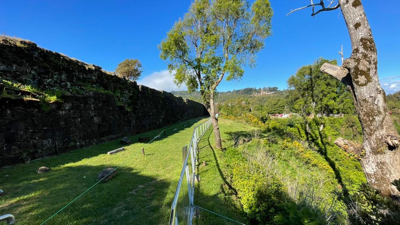
Este muro de defensa interior construido en el siglo dieciocho, da una vista hacia el estuario, la isla y el castillo de Mancera, la batería del Piojo, el estero La Huairona y el muelle ya desaparecido. Su línea recta da firmeza al relleno interior del patio de armas. Abajo, en la playa, yace la punta del baluarte, caído durante el gran terremoto de 1960.
This inner defense wall built in the eighteenth century, overlooks the estuary, the island and the castle of Mancera, the battery of Piojo, the estuary La Huairona and the now disappeared pier. Its straight line gives firmness to the inner filling of the parade ground. Below, on the beach, lies the tip of the bastion, fallen during the great earthquake of 1960.
This inner defense wall built in the eighteenth century, overlooks the estuary, the island and the castle of Mancera, the battery of Piojo, the estuary La Huairona and the now disappeared pier. Its straight line gives firmness to the inner filling of the parade ground. Below, on the beach, lies the tip of the bastion, fallen during the great earthquake of 1960.